Maps integration
mapsLink NC Maps locations to Open Register objects. Cached lat/lon means the map renders without a per-load API call. Detail-page widget shows an inline mini-map. Provider stub today.
Pin geolocations to an Open Register object via NC Maps. The Location tab will list linked points with an embedded map; the detail-page widget shows an inline mini-map. Geocoding flows through Maps' own backend (Nominatim or configured provider). Provider registers today; the wrapping MapLocationService + link table land in a follow-up.
Screenshot
The integration registers in OpenRegister's in-page registry and renders as one of the tabs on the standalone integrations view. The tab is highlighted active here so you can see exactly which surface this leaf controls.
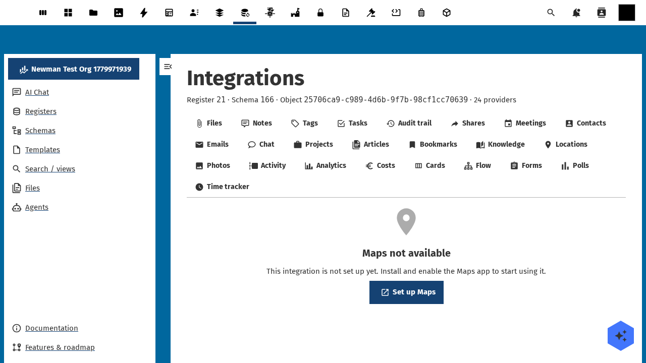
Captured by tests/e2e/leaf-screenshots.spec.ts against the seeded integration-verification register on the dev container. Empty state (Nothing linked yet) is expected on a freshly seeded object — link an upstream entity from the tab's + Add affordance to populate it.
What it will do
- Lists locations linked to each Open Register object on the Location sidebar tab. Shows an embedded map plus a list view.
- Renders an inline mini-map on the detail-page widget.
- Caches
lat/lonon the link row so the map renders without per-load geocoding. - Lets users add by address (NC Maps geocodes it) or by clicking on a picker map.
- Lets users unlink. The Maps point stays in Maps.
Setup
1. Install NC Maps
Install the maps Nextcloud app. The Location tab appears once it's enabled.
2. Use it on an object
Open any object whose schema declares linkedTypes: ['maps']. The Location tab appears. Today it renders the empty state until the wrapping service lands.
Configuration
| Field | Open Register side | NC Maps side |
|---|---|---|
| Storage | link-table (openregister_map_links, pending) — with cached lat / lon | NC Maps' own location store |
| Geocoding | Delegated to NC Maps (Nominatim or configured provider) | — |
| Refresh | Cached on link; geocode on update | — |
Local verification setup
The leaf-verification harness in tests/e2e/leaf-verification.spec.ts probes every advertised provider against the seeded integration-verification register; you can reproduce a single-leaf check by hand against any OpenRegister dev container.
1. Install the maps Nextcloud app
docker exec -u www-data nextcloud php occ app:install maps
docker exec -u www-data nextcloud php occ app:enable maps
docker exec nextcloud apache2ctl graceful   # bust OPcache so the registry sees the new app
Without maps enabled, the maps provider reports enabled: false on the OCS capabilities payload and its sub-resource endpoint refuses to dispatch.
2. Probe the registry to confirm the provider is advertised
curl -s -u admin:admin -H 'OCS-APIRequest: true' \
  http://localhost:8080/ocs/v2.php/cloud/capabilities?format=json \
  | jq '.ocs.data.capabilities.openregister.integrations.providers[] | select(.id == "maps")'
Expected payload — the enabled flag flips to true once the required app is installed.
3. Probe the per-object sub-resource
curl -s -u admin:admin -H 'OCS-APIRequest: true' \
  "http://localhost:8080/index.php/apps/openregister/api/objects/21/166/25706ca9-c989-4d6b-9f7b-98cf1cc70639/integrations/maps"
Most recent harness run (against the seeded verification-probe object on this dev container):
- Status:
200(list-envelope) - Latency: 85ms
- Body: matches the documented list envelope below
{
  "items": []
}
The OCS-APIRequest: true header is mandatory — without it, Nextcloud's session-CSRF guard short-circuits with HTTP 412 before the provider runs. An empty items: [] is the correct response for a freshly-seeded object that hasn't been linked to any upstream maps entity yet.
Current status
Provider registered. Wrapping service + link table tracked under openspec/changes/integration-maps.
Related
- Leaf integration system — how every leaf wires the same way.
- Pluggable integration registry — the full ADR-019 contract.